Subject · AD 43 to about 410
Six lessons on the 360 years when most of Britain was part of the Roman empire, told from the stones, letters and burnt layers it left behind.
It began with an invasion of about 40,000 men in AD 43, and ended early in the 400s, when the emperor refused to defend Britain any more.12
The lessons in time
The map
Move the year to see which places were Roman at the time.
- Main road, line documented
- Other road, line documented
- Road on weaker evidence
- Hadrian’s Wall, from AD 122
- Antonine Wall, about 142 to 160
- A place we cover
About the roads. Most Roman roads survive only as lines in fields, hedges and later roads. The Itiner-e atlas grades each one by how sure its line is; even the best-known British roads are graded “conjectured”: documented, but placed with some uncertainty.4
The six lessons
In order, like milestones on a road.
Every lesson is written for anyone. Choose a course and the lessons that match it are marked.
National curriculum, Key Stage 2: “the Roman Empire and its impact on Britain”
The curriculum names Julius Caesar, Claudius’s invasion, Hadrian’s Wall, Boudica and “Romanisation”. Every lesson here fits; start at the beginning.
We are not an exam board. Check the details against your own course.
OCR GCSE Ancient History (J198): Britannia, from conquest to province, AD 43 to c.84
This depth study stops around AD 84, so the invasion, Boudica and the new towns are the lessons that match. Hadrian’s Wall comes after it.
We are not an exam board. Check the details against your own course.
OCR A Level Ancient History (H407): Ruling Roman Britain, AD 43 to c.128
This depth study runs to about AD 128, so it takes in the Wall and the frontier letters from Vindolanda as well as the conquest.
We are not an exam board. Check the details against your own course.
55 BC to AD 47
The invasion
Why did Rome invade Britain in AD 43, and how did it win?
Caesar came and went. Claudius needed a victory, and sent about 40,000 men.
Fits: Primary (KS2) · GCSE · A level
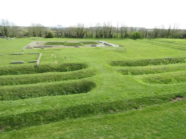
Photo: Colin Smith, CC BY-SA 2.0, via Geograph AD 60 to 61
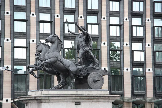
Boudica’s revolt
Why did Boudica rebel, and how much can we trust the story?
A queen whipped, three towns burnt, and two Roman accounts that do not agree.
Fits: Primary (KS2) · GCSE · A level
Photo: Richard Croft, CC BY-SA 2.0, via Geograph AD 122 to 410
Hadrian’s Wall
What was the Wall for, and how was it built?
An emperor’s order, a plan that changed while it was being built, and one Roman mile drawn to scale.
Fits: Primary (KS2) · A level
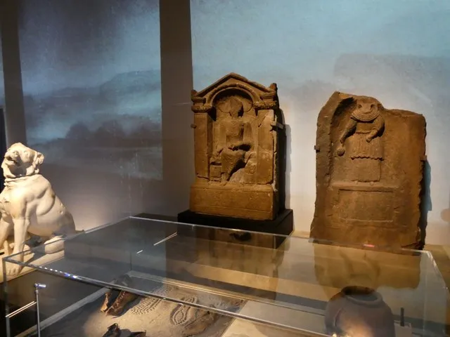
Photo: Rob Farrow, CC BY-SA 2.0, via Geograph About AD 85 to 400
Life on the frontier
Who actually lived on the northern frontier?
A birthday invitation on wood, a Syrian and his British wife, and soldiers from Belgium and Romania.
Fits: Primary (KS2) · A level
Photo: Jeremy Bolwell, CC BY-SA 2.0, via Geograph AD 47 to about 300
Towns and the new life
How did Roman rule change the way people lived?
New towns on new roads, a sacred hot spring, and the people who moved in.
Fits: Primary (KS2) · GCSE · A level
Photo: David Dixon, CC BY-SA 2.0, via Geograph About AD 250 to 500
How it ended
Did Roman Britain fall, or fade away?
Raiders from the sea, an emperor of Britain, and an army that was never paid again.
Fits: Primary (KS2)
Photo: David Martin, CC BY-SA 2.0, via Geograph
Places: along Hadrian’s Wall
The frontier: forts, a supply town, and the people who manned them for three centuries.
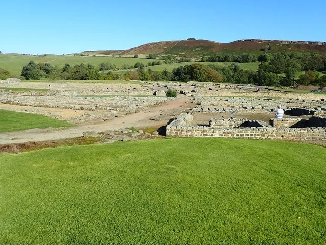
Fort · Vindolanda
Vindolanda
About AD 85 to after 400
A fort rebuilt again and again south of Hadrian’s Wall, where letters on wood survived.
Photo: Eirian Evans, CC BY-SA 2.0, via Geograph
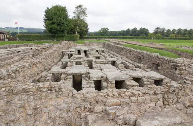
Town · Coria
Corbridge
Forts from about AD 86; a town until the early 400s
Forts at a river crossing, then a legionary supply base, then a town that fed the Wall.
Photo: David P Howard, CC BY-SA 2.0, via Geograph
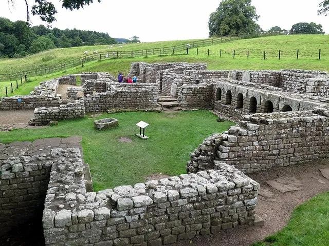
Fort · Cilurnum
Chesters
Built about AD 124; held into the 400s
A fort for 500 horsemen built straight across the Wall where it crossed the North Tyne.
Photo: Andrew Curtis, CC BY-SA 2.0, via Geograph
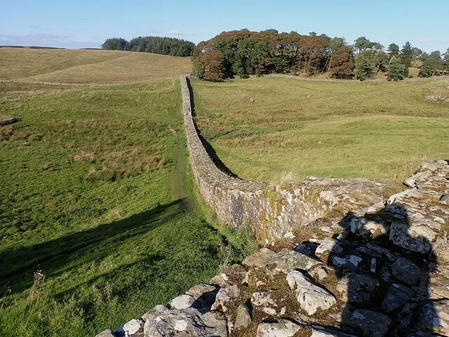
Fort · Vercovicium
Housesteads
Begun within a decade of AD 122; held to about 400, perhaps later
The most complete Roman fort in Britain, on a ridge in the middle of Hadrian’s Wall.
Photo: Rob Farrow, CC BY-SA 2.0, via Geograph
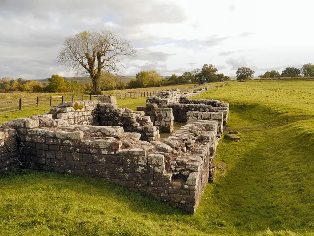
Fort · Banna
Birdoswald
Built soon after AD 122; lived in until about 500
Home of a Dacian cohort for two centuries, and lived in for about a hundred years after Roman rule ended.
Photo: David Dixon, CC BY-SA 2.0, via Geograph
Places: the gateway and the shore
Where the Romans came in, and where they later built walls against raiders from the sea.
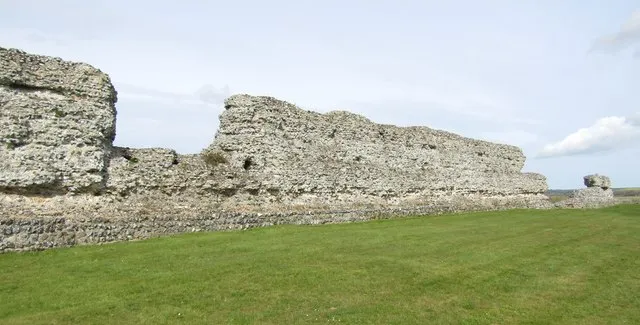
Port and fort · Rutupiae
Richborough
AD 43 to the early 400s
Where the invasion army probably came ashore, then the official gateway to Britain under a marble arch.
Photo: Colin Smith, CC BY-SA 2.0, via Geograph
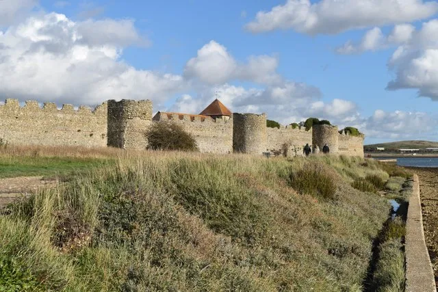
Saxon Shore fort · Portus Adurni (probably)
Portchester
Probably built AD 285 to 290
The best-preserved Roman fort north of the Alps, built to guard a harbour against raiders from the sea.
Photo: David Martin, CC BY-SA 2.0, via Geograph
Places: towns and a fortress
New towns on new roads, a sacred spring, and the legion’s base in the north.
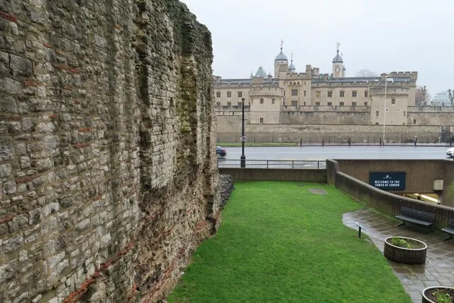
Town · Londinium
London
Founded AD 47 to 50; empty by about 450
A new town on the Thames that became the biggest in the province, was burnt, rebuilt, walled and left.
Photo: Philip Halling, CC BY-SA 2.0, via Geograph
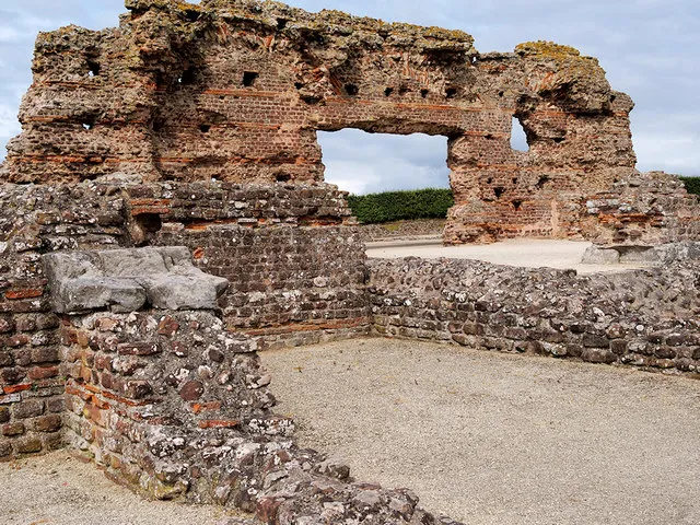
Town · Viroconium
Wroxeter
Fort about AD 47; city from the 90s; centre empty by the mid 400s
A legionary fortress that became one of the largest cities in Roman Britain, with most of it still unexcavated.
Photo: David Dixon, CC BY-SA 2.0, via Geograph
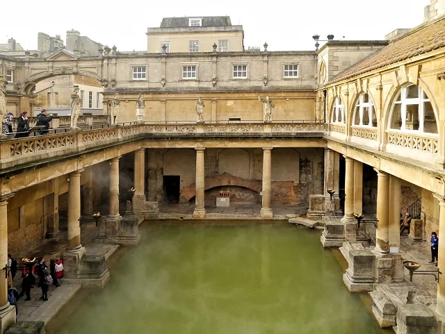
Town · Aquae Sulis
Bath
Founded in the later first century AD
A hot spring, a goddess and a great bath, where people threw curses written on lead into the water.
Photo: David Dixon, CC BY-SA 2.0, via Geograph
Legionary fortress · Eboracum
York
Founded in or around AD 71
Fortress of the Ninth Legion, later capital of the north. One emperor was acclaimed here and two died here. Founded in or around AD 71 by the 5,000 men of the Ninth Legion, where the Ouse and the Foss meet.3 Its own page is still being researched.
Where experts disagree: how did Boudica die?
By poison, says Tacitus.Writing about fifty years after the revolt, Tacitus says Boudica ended her life with poison after the defeat.5
Of illness, says Dio.Cassius Dio, writing in Greek about a century after Tacitus, says she fell sick and died. Both were elite Romans, and neither was there. Read the whole story.6
Sources for this page
Every number on this page comes from one of these. How we check.
Last reviewed 12 November 2026. Spotted a mistake? Tell us.
- The Roman invasion of Britain, AD 43. English Heritage, Story of England: Romans. www.english-heritage.org.uk/learn/story-of-england/romans/invasion/Used for: Why Claudius invaded, the size of the army, and the debate over where it landed. Checked 12 November 2026.
- London Museum. A timeline of Roman London: Londinium from start to end. www.londonmuseum.org.uk/collections/london-stories/timeline-roman-london-londinium/Used for: Londinium: founding, population, the fires, the wall, the provinces and the end. Checked 12 November 2026.
- York Archaeological Trust and partners. History of York: Roman York (Eboracum). www.historyofyork.org.uk/themes/romanUsed for: York: its founding by the Ninth Legion around AD 71, and the emperors acclaimed and died there. Checked 12 November 2026.
- Brughmans, T., de Soto, P., Pažout, A. and Bjerregaard Vahlstrup, P. (2024). Itiner-e: the digital atlas of ancient roads. CC BY 4.0. British roads as extracted in Hotham, T. (2026), How Roman is your road? Data and code, Zenodo, doi:10.5281/zenodo.23673516. itiner-e.orgUsed for: Every Roman road on the map, with how certain its line is. Checked 12 November 2026.
- Tacitus, Annals, book 14, chapters 29 to 39 (written in the early 2nd century AD). Translated by J. Jackson, Loeb Classical Library, 1937, public domain; online at LacusCurtius (Bill Thayer). penelope.uchicago.edu/Thayer/E/Roman/Texts/Tacitus/Annals/14B*.htmlUsed for: Boudica’s revolt as a Roman senator told it, about fifty years later. Checked 12 November 2026.
- Cassius Dio, Roman History, epitome of book 62 (written around AD 200). Translated by E. Cary, Loeb Classical Library, 1925, public domain; online at LacusCurtius. penelope.uchicago.edu/Thayer/E/Roman/Texts/Cassius_Dio/62*.htmlUsed for: Boudica as Dio described her, and his figures for the revolt. Checked 12 November 2026.
- Natural Earth, 1:110m and 1:50m land, public domain, via the world-atlas package by Mike Bostock (ISC licence). www.naturalearthdata.com/Used for: Every coastline drawn on this site. Checked 11 November 2026.