Fort · Cumbria, England

Birdoswald

Roman name: Banna

On a spur above a bend in the River Irthing, a fort was home to a thousand-strong cohort from what is now Romania. When Roman rule ended, people kept living here for another hundred years.

RichboroughLondonWroxeterBathYorkVindolandaCorbridgeChestersHousesteadsPortchesterBirdoswald
Other dots are the places we cover. Wall lines simplified. Coast: Natural Earth.
Built
soon after AD 1221
Area
2.14 hectares
Longest garrison
1,000 Dacians, from Romania
Lived in until
about AD 500, perhaps later
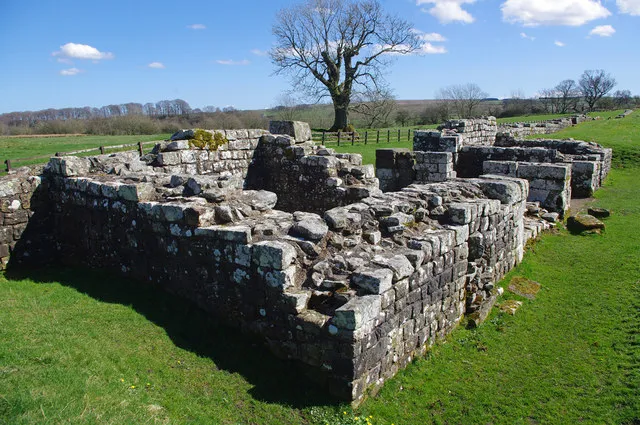
Low stone walls of a ruined Roman building in a grassy field, with a large tree behind
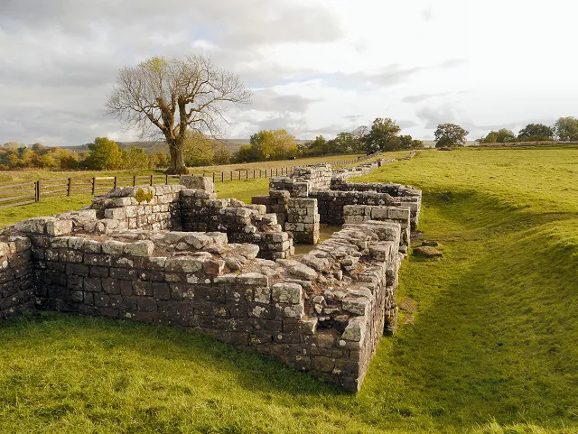
Ruins inside the fort. The walls are buried deeper on the downhill side, because soil and rubble slid down the slope over the centuries.Photo: David Dixon, CC BY-SA 2.0, via Geograph

The story of Birdoswald

The story starts with trees. In AD 122 the builders of Hadrian’s Wall cleared a wooded spur here and drained a small bog. West of the River Irthing the Wall was first built of turf, not stone. The oldest thing found on the site is the builders’ own camp, with a ditch and a fence; pieces of their leather tents turned up in the ditch.1

The fort came soon after. It was built across the Wall, so part of the turf Wall and one stone turret, number 49a, were pulled down to make room. Work seems to have stopped for some years, then started again, and the fort was finished before Hadrian died in AD 138. At 2.14 hectares it was one of the larger forts on the Wall. Then the turf Wall near it was rebuilt in stone, on a new line further north.1

The Dacians

After the brief move north to the Antonine Wall, about AD 142 to 160, Birdoswald was fully manned again, probably by the unit that then stayed through the 3rd and 4th centuries: the cohors I Aelia Dacorum, a thousand-strong cohort raised in Dacia, now Romania.1

Two of their building stones are carved with a palm branch and the falx, the curved sword of the Dacians. One records a granary built in AD 205 to 208, with help from a cohort of Thracians, under the tribune Aurelius Julianus. While he was here, Julianus lost his baby son, Aurelius Concordius, whose tombstone was found in the fort’s cemetery. The other stone records work on the east gate in AD 219.1

The Dacians set up at least 23 altars to Jupiter, Best and Greatest. Outside the walls a village grew along streets to the east, west and even north. South of the fort, timber buildings and pottery like that of Frisia show another, irregular unit living in its own way.1

After Rome

Birdoswald is one of the best places in Britain to see what happened when Roman rule ended. On the site of the granaries, archaeologists found a series of halls. The first reused the southern granary. When that became unsafe, two timber halls were built, one after the other, on the site of the northern granary. People lived here without a break from the late Roman period, probably into the early 6th century.1

The soldiers had long been local men serving because their fathers had. Without an empire to pay them, the garrison may have become something like a war band, or a small local lordship, whose people still thought of themselves as Roman.1

Where the evidence is unclear

Was it empty in the late 3rd century?The last inscription from Birdoswald records rebuilding the commander’s house, which had been “covered in earth and fallen into ruin”. That suggests a short gap, but not how long.1

Did the Dacians stay to the end?The Notitia Dignitatum, a late Roman list of army posts, still puts them here. But historians doubt how reliable it is for the western empire.1

Raiders and romantics

In the Middle Ages the fort walls made a handy enclosure. A small tower house went up by the west gate in the 1400s. In the 16th century the Tweddle family lived in a fortified farmhouse inside the walls, with animals below and people above, and complained to the Warden of the West March three times, in 1588 and 1590, after raiders took their cattle. In 1599, in the middle of all this, the first antiquarian visitor, Reginald Bainbrigg, came to look at the ruins. In the mid 1800s the landowner Henry Norman dug out the fort walls and gates and gave the farmhouse its mock-medieval tower, and that is largely the Birdoswald you see today.12
Digging down

What lies on one spot, from the grass to the first camp.

Grass today

  1. 1858The farmhouse tower. Henry Norman’s mock-medieval tower and the dug-out fort walls around it.
  2. 1500sA fortified farmhouse. Built inside the fort walls, on top of the Roman workshop. Raided for cattle in 1588 and 1590.
  3. 1400sA tower house. Beside the Roman west gate, which was still standing then.
  4. About 400 to 500Timber halls. Two halls, one after the other, on the site of the north granary.
  5. AD 205 to 208Stone granaries. Built by the Dacians and a Thracian cohort.
  6. By AD 138The stone fort. Begun perhaps in turf and timber, finished in stone.
  7. AD 122The builders’ camp. A ditch and fence, with scraps of leather tent.
A simplified section: not every layer is under every part of the fort. Red marks the Roman layers.

Birdoswald through time

1,800 years on one spur.

  1. AD 122Woods cleared The builders of the Turf Wall arrive.
  2. AD 205Granary built AD 205 to 208, by the Dacians and Thracians.
  3. AD 219East gate Building work recorded on a Dacian stone.
  4. AD 500Halls end Living on the site probably ends in the early 6th century.
  5. AD 1194First named 1194 to 1232: a man “de Bordeswald” witnesses charters.
  6. AD 1588Cattle raids Twice in 1588 and again in 1590.
  7. AD 1858Farm tower Henry Norman’s tower, built after he dug out the fort walls.
Dated events only. Red: Roman. Black: after Rome. Spacing is true to time.

What is there today

Photographs by visitors, shared under an open licence.

The stone base of a Roman gateway with two passages, in grass
The main east gate, the best preserved on Hadrian’s Wall. Building work here in AD 219 is recorded on a stone carved with a Dacian sword.Photo: Sandy Gerrard, CC BY-SA 2.0, via Geograph
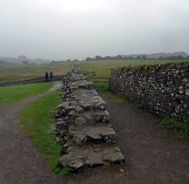
A path running beside a long stretch of low stone wall into mist
Hadrian’s Wall heading east from the fort. Here it still stands up to 2.5 metres high.Photo: habiloid, CC BY-SA 2.0, via Geograph
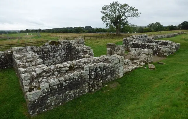
Ruined Roman stone walls in grass under a blue sky
Roman walls at Birdoswald. Apart from the north-east corner, which a modern road cuts across, the whole circuit is uncovered.Photo: Ian Taylor, CC BY-SA 2.0, via Geograph

Sources for this page

Every number on this page comes from one of these. How we check.

Last reviewed 12 November 2026. Spotted a mistake? Tell us.

  1. Wilmott, T. History of Birdoswald Roman Fort. English Heritage. (Senior Archaeologist, Historic England; excavator of Birdoswald.) www.english-heritage.org.uk/visit/places/birdoswald-roman-fort-hadrians-wall/history-and-stories/history/Used for: Birdoswald: the Turf Wall, the Dacian cohort, and the timber halls after Rome. Checked 12 November 2026.
  2. Description of Birdoswald Roman Fort. English Heritage. www.english-heritage.org.uk/visit/places/birdoswald-roman-fort-hadrians-wall/history-and-stories/history/description/Used for: Birdoswald: the gates, the granaries, the Turf Wall turret and the Victorian farmhouse. Checked 12 November 2026.
  3. Pleiades: a gazetteer of past places. Institute for the Study of the Ancient World, New York University. CC BY 3.0. pleiades.stoa.orgUsed for: Roman names of places and their positions. Checked 12 November 2026.
  4. Natural Earth, 1:110m and 1:50m land, public domain, via the world-atlas package by Mike Bostock (ISC licence). www.naturalearthdata.com/Used for: Every coastline drawn on this site. Checked 11 November 2026.