Fort · Northumberland, England

Housesteads

Roman name: Vercovicium

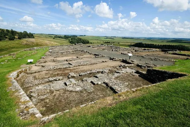
Halfway along Hadrian’s Wall, on a ridge with a long view north, is the most complete Roman fort in Britain. For almost three hundred years it was home to soldiers from what is now Belgium.

RichboroughLondonWroxeterBathYorkVindolandaCorbridgeChestersBirdoswaldPortchesterHousesteads
Other dots are the places we cover. Wall lines simplified. Coast: Natural Earth.
Begun
within ten years of AD 1221
Area
2.2 hectares
Built for
800 infantry
Held until
about AD 400, perhaps later
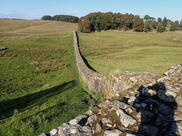
Hadrian’s Wall running away north-east from Housesteads along the top of a grassy ridge
Hadrian’s Wall heading north-east from the fort. The Wall was here first; the fort was built up against it.Photo: Rob Farrow, CC BY-SA 2.0, via Geograph

The story of Housesteads

Building Hadrian’s Wall began in AD 122. At first there were no forts on the Wall itself, only small fortlets and towers. Housesteads was added soon after. The builders started the fort before they had finished the Wall here, and a cremation burial was found under the fort’s north-west corner. Romans buried their dead outside forts, never inside, so that burial must be older than the fort. That suggests more than a year passed between building the Wall and building the fort.1

The fort covered 2.2 hectares and was planned from the start for a regiment of 800 infantry, a milliary cohort. These were auxiliaries: soldiers recruited from peoples Rome had conquered, not Roman citizens. By the end of Hadrian’s reign in AD 138 the Wall was finished, with 15 forts and nearly 10,000 men along it.1

Who lived here

From the late 2nd century to the 4th, the garrison was the First Cohort of Tungrians, raised among German-speaking tribes around Tongeren, in what is now Belgium. The same unit had earlier served at Vindolanda, two miles away.1

In the early 3rd century two more units joined them, both recruited beyond the Rhine in Frisia, now the north of the Netherlands: the cuneus Frisiorum, or “wedge of Frisians”, and the numerus Hnaudifridi, a band named after its leader, Hnaudifrid. A kind of pottery found at Housesteads from this time matches pottery from Frisia, so these men kept cooking the way they had at home.1

Outside the walls a village of traders and families grew up. It was at its largest through the 3rd century and largely abandoned near its end, when the barracks inside were rebuilt and the garrison probably shrank. People who had lived outside may have moved inside the walls for safety.1

A prayer against plague

One stone from Housesteads is a dedication by the Tungrians “to the gods and goddesses”, following the advice of the oracle of Apollo at Claros, in what is now western Turkey. Ten inscriptions like it are known from across the empire, and all have been linked to the great plague that broke out around AD 165. Soldiers at the far north-west edge of the empire were following instructions from a shrine nearly 3,000 kilometres away.1

Where the evidence is unclear

Was the Wall emptied in the 140s?When Antoninus Pius built a new wall in Scotland, it is often said Hadrian’s Wall was given up. Recent digging at Housesteads found no sign of that, and an altar set up by legionaries “on garrison duty” may date from then.1

When did the soldiers leave?The last dated inscription is from about AD 300. A late Roman list of army posts, the Notitia Dignitatum, still names a garrison here, but no one knows exactly when that part of the list was written.1
How big

Housesteads against Vindolanda’s last fort and a football pitch.

Housesteads, 2.2 haVindolanda, last fort, 1.4 ha

Blue outline: a football pitch, 105 × 68 m. Housesteads: about 3.1 pitches. Vindolanda, last fort: about 2 pitches.

Each area drawn as a square at the same scale, so the sizes compare fairly. The real forts were rectangles with rounded corners.

Housesteads is about one and a half times the size of the last fort at Vindolanda, its neighbour two miles away. It was planned for a cohort of 800 men.1

Even so, the whole fort would fit on about three football pitches, with its barracks, granaries, hospital, headquarters and the commander’s house all inside.

Housesteads through time

From the Wall to the antiquarians.

  1. AD 122Wall begun The fort is added within ten years.
  2. AD 165Plague dedication About this date: the Tungrians’ prayer to “the gods and goddesses”.
  3. AD 205Granaries rebuilt AD 205 to 208.
  4. AD 300Last inscription About AD 300.
  5. AD 1599Thieves’ den By about 1600 the site was notorious for rustlers, and the antiquary William Camden stayed away.
  6. AD 1725First drawing William Stukeley sketches the fort.
Dated events only. Red: Roman. Black: after Rome. Spacing is true to time.

What is there today

Photographs by visitors, shared under an open licence.

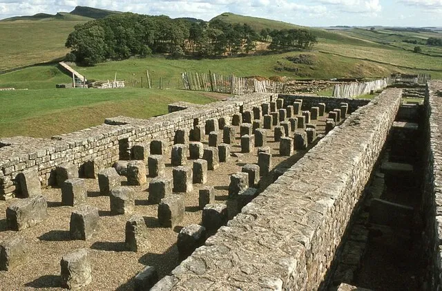
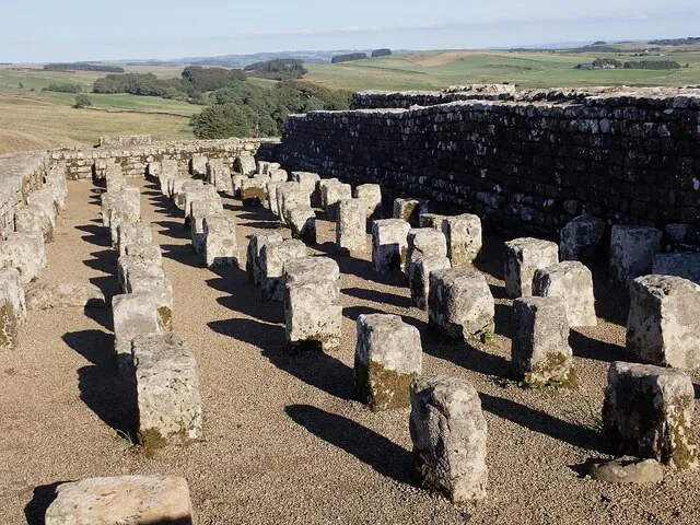
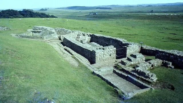
Rows of short stone pillars in the floor of a ruined building
The granary floor. Stone pillars held the floor up so air could move underneath and keep the food dry and away from vermin.Photo: Rob Farrow, CC BY-SA 2.0, via Geograph
A stone-lined channel around the edge of a small rectangular ruin
The latrine block in the corner of the fort. A channel of running water ran below the seats.Photo: Sandy Gerrard, CC BY-SA 2.0, via Geograph
Low stone walls of long narrow buildings in grass
Barracks. Most were left as built until near the end of the 3rd century, when they were rebuilt as separate small houses.Photo: Jeff Buck, CC BY-SA 2.0, via Geograph
Ruined walls of the fort on a slope, with fields beyond
The fort from inside its walls, looking across the slope it was built on.Photo: Philip Halling, CC BY-SA 2.0, via Geograph

Sources for this page

Every number on this page comes from one of these. How we check.

Last reviewed 12 November 2026. Spotted a mistake? Tell us.

  1. Crow, J. History of Housesteads Roman Fort. English Heritage. (Professor of Classical Archaeology, University of Edinburgh; author of the English Heritage guide to Housesteads.) www.english-heritage.org.uk/visit/places/housesteads-roman-fort-hadrians-wall/history/Used for: Housesteads: size, date, garrison, the Tungrians and Frisians, and the end of the fort. Checked 12 November 2026.
  2. Pleiades: a gazetteer of past places. Institute for the Study of the Ancient World, New York University. CC BY 3.0. pleiades.stoa.orgUsed for: Roman names of places and their positions. Checked 12 November 2026.
  3. Northumberland County Council, Keys to the Past (Historic Environment Record N6566). Vindolanda Roman fort (Chesterholm), Henshaw. keystothepast.info/Site-Details?PRN=N6566Used for: The sequence of forts at Vindolanda, their dates, sizes and garrisons, and the finding of the writing tablets. Checked 11 November 2026.
  4. Natural Earth, 1:110m and 1:50m land, public domain, via the world-atlas package by Mike Bostock (ISC licence). www.naturalearthdata.com/Used for: Every coastline drawn on this site. Checked 11 November 2026.