Chapter Two
Cities under the trees
Found in 2016 and 2017; most from AD 650 to 800
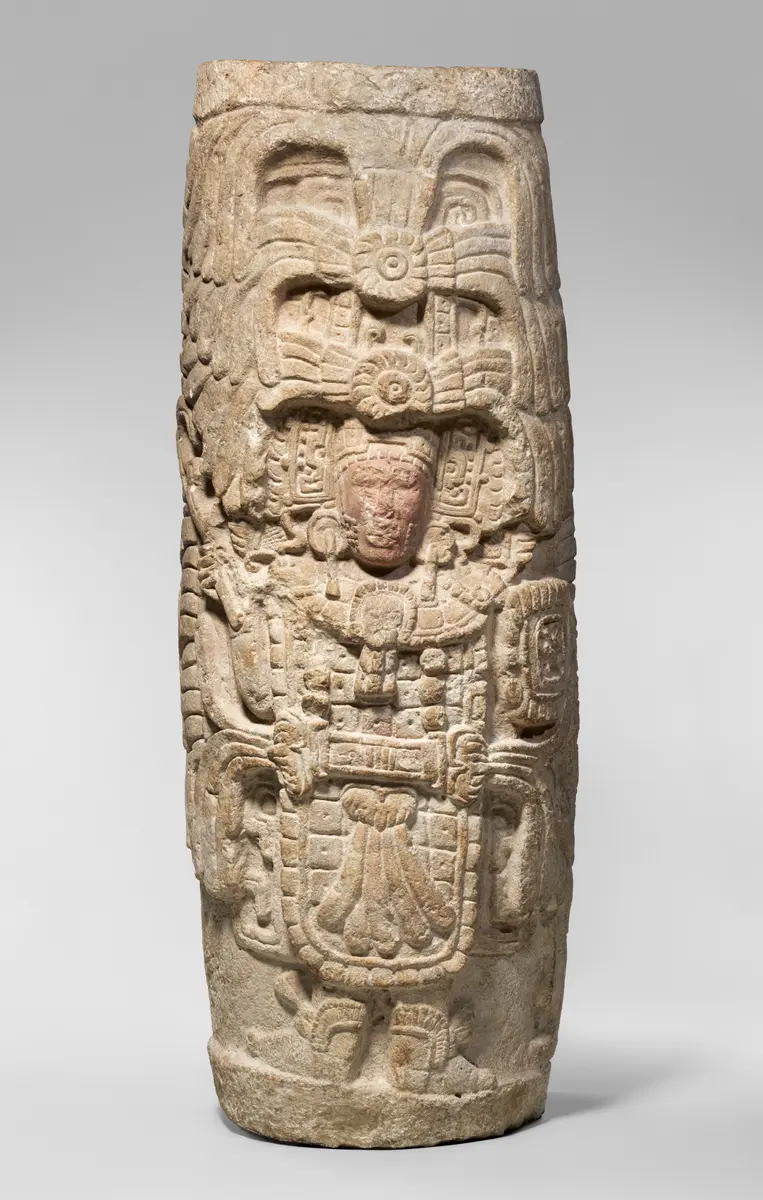
A carved stone column from a Maya building in Mexico, AD 800 to 900. Lidar shows thousands of buildings like the one it came from. Photo: The Metropolitan Museum of Art, CC0, via The Met Open Access.
The questionHow did lasers fired from aircraft change what we know about Maya cities?
Archaeologists used to find Maya ruins in the forest of northern Guatemala one at a time, on foot. Then a laser scanner flown over the trees showed, in minutes, what would have taken years of fieldwork. Under the canopy were whole landscapes: houses, roads, fields and walls.
Fits: Primary (KS2). See Courses.
Seeing through the trees
Lidar stands for light detection and ranging. A scanner in an aircraft maps the ground with laser light, and it can see through thick forest canopy to the shape of the earth beneath.1 A mound that is a buried house, or a ridge that is a buried wall, shows up even where the trees hide it.
The survey covered more than 2,100 square kilometres of the Maya Biosphere Reserve in northern Guatemala. A team of 18 scholars from the United States, Europe and Guatemala studied the scans, with the help of PACUNAM, the Mayan Heritage and Nature Foundation, and published what they found in the journal Science in 2018.1
What was under the forest
- 61,480buildingsFrom houses to palaces and pyramids, in the parts of the forest that were scanned.1
- 362 km²of terraces and reshaped fieldsLand the Maya had changed to farm it.1
- 952 km²of good farmlandLand that could be farmed.1
- 106 km²of causewaysRaised roads joining cities to the land around them.1
- Manydefensive earthworksLarge banks and ditches, a sign of war. The report does not count them.1
The archaeologists said the scans showed in “a matter of minutes” what would have taken years of work on foot.1 Lidar does not replace digging, though. Someone still has to walk to a sample of the places to check that a mound is really a building, and to date it.
How many Maya?
From the number of houses, the team estimated that 7 to 11 million people lived in the Maya lowlands at the busiest time, the Late Classic period, AD 650 to 800.1 That is a guess built on a count: it depends on how many houses were lived in at the same time, and how many people lived in each.
The roads and fields matter as much as the temples. They show that Maya cities were not lonely islands in the jungle, but the centres of farmed, connected countryside. The causeways and earthworks also show, the researchers said, the scale of Maya warfare.1
Key words
- Lidar
- Light detection and ranging: mapping the ground with laser pulses fired from an aircraft.
- Canopy
- The roof of leaves and branches at the top of a forest.
- Survey
- A careful study of an area to record what is there.
- Ground-truthing
- Going to a place on foot to check that what a map or scan shows is really there.
- Terrace
- A flat step cut into a slope, so it can be farmed.
- Population
- The number of people living in a place.
Check yourself
Try to answer in your head, then open each one.
Roughly how many ancient structures did the lidar survey find?
More than 61,000: 61,480.
How many people did the researchers think lived in the area at its busiest?
About 7 to 11 million, in AD 650 to 800.
Name two kinds of thing, apart from buildings, that the survey found.
Any two of: causeways (raised roads), terraces and farmland, defensive earthworks.
Why is lidar useful in a forest?
It can show the shape of the ground under the trees, so ruins can be seen without clearing the forest.
Go deeper
- Before kings another monument found by lidar
- Drought, and the Maya today what happened to these cities
Sources for this page
Every number on this page comes from one of these. How we check.
Last reviewed 12 November 2026. Spotted a mistake? Tell us.
- Tulane University News (2018). Unprecedented study confirms massive scale of lowland Maya civilization. 27 September 2018. Reporting Canuto, M. A., Estrada-Belli, F., Garrison, T. G. and others (2018), Ancient lowland Maya complexity as revealed by airborne laser scanning of northern Guatemala, Science 361, eaau0137. news.tulane.edu/pr/unprecedented-study-confirms-massive-scale-lowland-maya-civilizationUsed for: The lidar survey of northern Guatemala: more than 2,100 square kilometres, 61,480 structures, causeways, farmland, defences, and 7 to 11 million people in AD 650 to 800. Checked 12 November 2026.
- Mace, M. (2020). Largest, oldest Maya monument suggests importance of communal work. University of Arizona News, 3 June 2020. Reporting Inomata, T., Triadan, D. and others (2020), Monumental architecture at Aguada Fénix and the rise of Maya civilization, Nature 582, 530–533. news.arizona.edu/news/largest-oldest-maya-monument-suggests-importance-communal-workUsed for: Aguada Fénix: its size, nine causeways, dating to 1000 to 800 BC from 69 charcoal samples, found from lidar in 2017, no sign of powerful rulers, and Ceibal as the earlier record. Checked 12 November 2026.
- The Metropolitan Museum of Art. Column. Maya, Mexico, limestone and pigment, 800–900 CE. Collection record 310540, Open Access (CC0). www.metmuseum.org/art/collection/search/310540Used for: A carved stone column from a building, 173.4 cm high. Checked 12 November 2026.